Giving out $10 USD or a free premium version of our app at launch to 20 random people who waitlist!
Navigation that checks for danger, not just traffic.
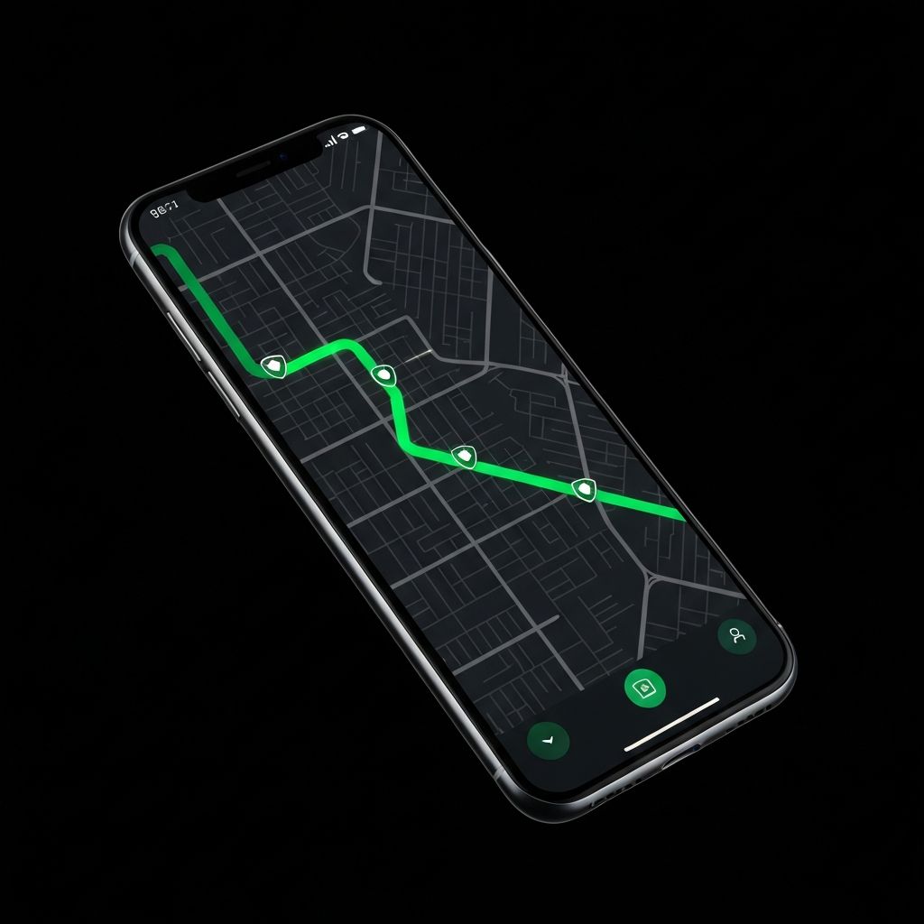
The first GPS that routes you through the safest streets — so you get there safe, not just fast.
Navigate to
Market St, San Francisco
Safest Route
12 min · 4.2 km
Safety Score
9/10Features
Built for the streets you actually drive
Predictive Avoidance
Machine learning predicts unsafe areas before you arrive, not just after. Get rerouted in real-time based on emerging threats.
Driver Behavior Insights
Learn your personal safety patterns. ViaShield tracks which route types are safest for you and your commute habits.
Multi-Stop Optimization
Plan multiple stops without sacrificing safety. Our algorithm finds the safest sequence to visit all your destinations.
Emergency Alerts & Assistance
Receive instant push notifications for dangerous incidents near your route. One-tap emergency button connects you directly with local authorities.
How it works
Safety-first navigation in three steps
Enter your destination
Type where you need to go, just like any other GPS app.
We score routes by safety
Our engine analyzes real-time crime data, lighting, and foot traffic to find the safest path.
Navigate confidently
Follow the route that keeps you safe, day or night.
From our community
Real stories from real commuters
I got mugged twice taking the “fastest route.” I wish something like this existed sooner.
— Commuter in São Paulo
Be the first to navigate safer.
Join our waitlist and get early access when we launch.